.jpg)


By Sarah Blizzard Robinson
The white sand, turquoise water, and ocean breezes may be what Gulf Shores and Orange Beach are known for, but for those who prefer a little shade (and in some cases, a lot of shade) the terrific trail system just north of East Beach Boulevard, in Gulf State Park fits the bill. The park boasts 28 miles of trails that traverse nine ecosystems, with a plethora of flora and fauna for nature enthusiasts.
If you’d like a break from all that sand between your toes, the solid surface of the trails is a terrific alternative. (Go dip your toes in the Gulf afterward.) You're good to go with a sturdy pair of athletic shoes and a water bottle. Gulf State Park--and her nearby, equally accessible Fort Morgan Road Trail have some of the nicest scenery and surfaces we have ever experienced.
The Trail Map, available from the website and on the trails, is a vital tool if you care to know where one trail begins and another one ends. We recently invited another couple to join us on our excursion. They borrowed bikes using the Bloom for Bikes borrowing system, an app for your phone. Instructions are spelled out on a sign above a rack of identical bikes, located throughout the park. You can borrow the wheels for up to three hours, free of charge. And if you’re like our friends who couldn’t wait to purchase their bikes, give Infinity Bicycles in Daphne a call. They did a terrific job reconditioning ours.
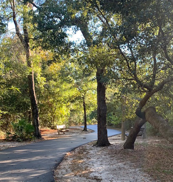
Our favorite trail, Gulf Oak Ridge, can be accessed from Longleaf Trace (see map). We arrived and parked in the first lot, accessed by taking the first right off of East Fort Morgan Road. The paved trail is obvious. We headed south until we came to a narrow pedestrian bridge to the left of the quiet highway. A well-maintained restroom and water station are on the other side of the bridge.
The beauty of South Alabama awaited us around every bend of the trail. A fresh pine scent wafted up from the trail floor, where seasoned pine straw is in abundance. Mostly level, the terrain presented some gentle rises and falls.
Three miles long, portions of this trail have no rivals. Mature oaks with sprawling limbs hang overhead. A bald eagle or a heron may hover above the trees. Sturdy benches, dedicated and carved in the memory of others who’ve enjoyed the trail are positioned throughout. Stop when you see the wildlife viewing platform to the left. Step up to the railing. You’ll be mere feet from an alligator preserve--no worries, they’re shy and won’t climb up to greet you. We’ve seen osprey soaring overhead, and once, a Halloween-like scene: a tree full of vultures.
Even further down the trail, park your bike where you see a raised deck with a narrow walking bridge. Follow to the overlook. With its tall condo buildings, the distant Orange Beach looms small in the distance, a pretty spectacular view from a surprising bluff on the trail.
The trails have become a social outlet more times than we can count. Friendly folks from all over the place have asked if they could assist us as we paused to consult the Trail Guide.
“Need some tips?” a woman on her bike stopped to ask us recently. We were open to suggestions. “How far do you want to go?” was her next question. I answered before Hubby had a chance because he’d bike 20 miles if it were up to him, but I’m more of a 30-minutes-out and 30-minutes-back rider. Same when I’m on foot, just a general rule. Biking covers more ground in less time, so I’m a bit more adventurous on wheels. I’ve ridden/walked much further, but I like being able to walk the next day.
We followed the loop the woman suggested, Catman Trail, which eventually put us on the Gopher Tortoise Trail and back where we started. Her partner told us we would be riding right through his favorite part, the RV Camp’s vast lot. We enjoyed riding right through, remarking on the size of some of the Class A’s and fifth-wheel motor homes. The aroma of grilled hamburgers made us wish we’d been invited to lunch at one of the campsites.
Here are some suggestions:
- Stretch before and after each excursion. It only takes a few minutes, and your muscles will thank you for it. Good stretching tips can be found here: 8 Best Stretching and Flexibility Moves for Cycling (verywellfit.com)
- Safety is crucial so that you can continue to enjoy these trails for a long, long time. Wear a helmet. Listen for other riders/walkers behind you. You might hear, “On your left.” This means swiftly moving to the right side of the path and letting others pass. Though the trails are wide, you may be single-file when the trails are busy.
***Fort Morgan Trail is a perfectly level track, running alongside, but well back from the road. Fort Morgan | Map, Guide - Alabama | AllTrails


More from
Sports & Fitness
category